

Our only home.
Oceans, clouds and continents share one unbroken horizon. Earth is the only world we know that supports life.
- Surface covered by ocean
- About 71%
- Mean radius
- 6,371 km
Day meets night
The boundary between daylight and darkness is called the terminator. As Earth turns, this boundary travels across its surface. The atmosphere scatters sunlight, softening the transition.
These NASA textures are historical composites. This is an artistic view of Earth, not a live observation.
NASA — Earth factsNASA — Earth fact sheetNASA — the terminatorStill, we move.
365.256 days around the Sun.Earth carries us around the Sun at an average 29.78 kilometres per second. We travel together, even when we feel still.
NASA — our orbit365.256days
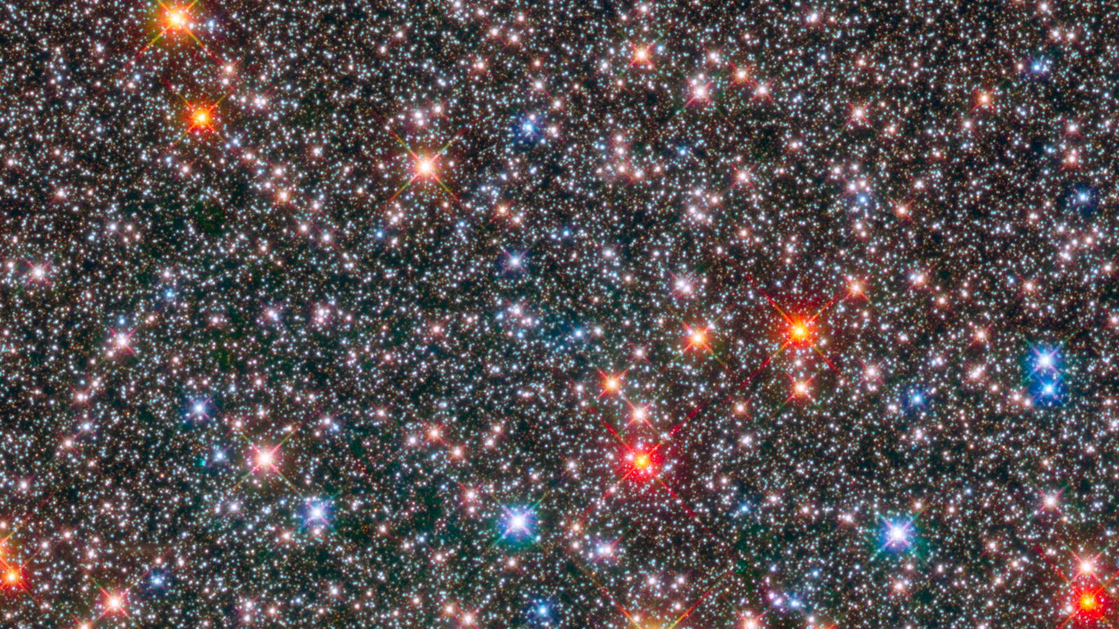
A year, measured by the stars.
One orbit of the Sun, measured against distant stars, is called a sidereal year. NASA JPL lists it as 365.25636 days.
Our name comes from this way of measuring a year. Rounded to three decimal places, 365.256 gives our address its digits: 365256.earth.
NASA / JPL — the dataWhy not 365?
The Gregorian calendar follows the seasons. A tropical year is about 365.2422 days, slightly shorter than a sidereal year because Earth’s axis slowly changes direction. Leap-year rules help keep calendar dates aligned with the seasons.
NASA on calendars NASA on Earth’s motionOne planet, seen from afar
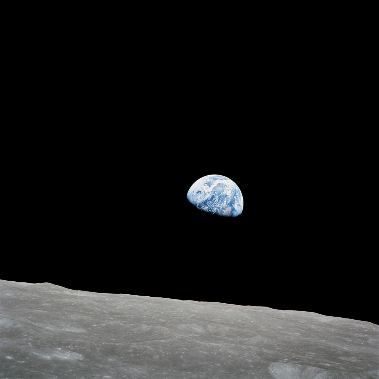
Earthrise
Bill Anders photographed Earth from Apollo 8 as it orbited the Moon.
Image details for Earthrise
The curved boundary between day and night is the terminator. In this photograph it crosses Africa, while North and South America lie beneath clouds beyond the Moon’s gray horizon.
Lunar orbit · 1968.12.24
NASA / Bill Anders
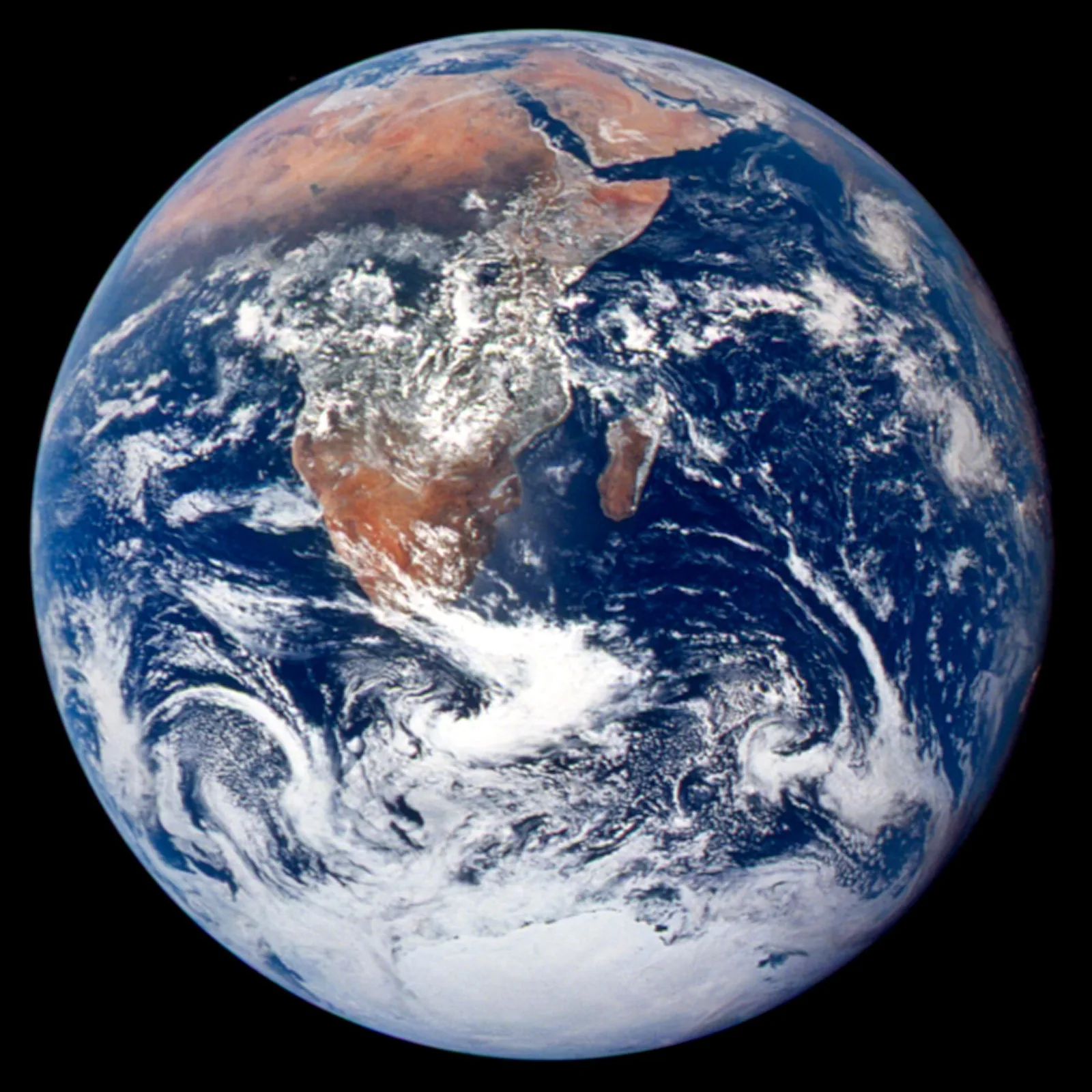
The Blue Marble
The Apollo 17 crew captured this sunlit Earth on their way to the Moon, with Africa and Antarctica in view.
Image details for The Blue Marble
For the first time, an Apollo trajectory made it possible to photograph the south polar ice cap. This view stretches from the Mediterranean to Antarctica, with almost all of Africa’s coastline visible.
En route to the Moon · 1972.12.07
NASA Johnson Space Center / Apollo 17 crew
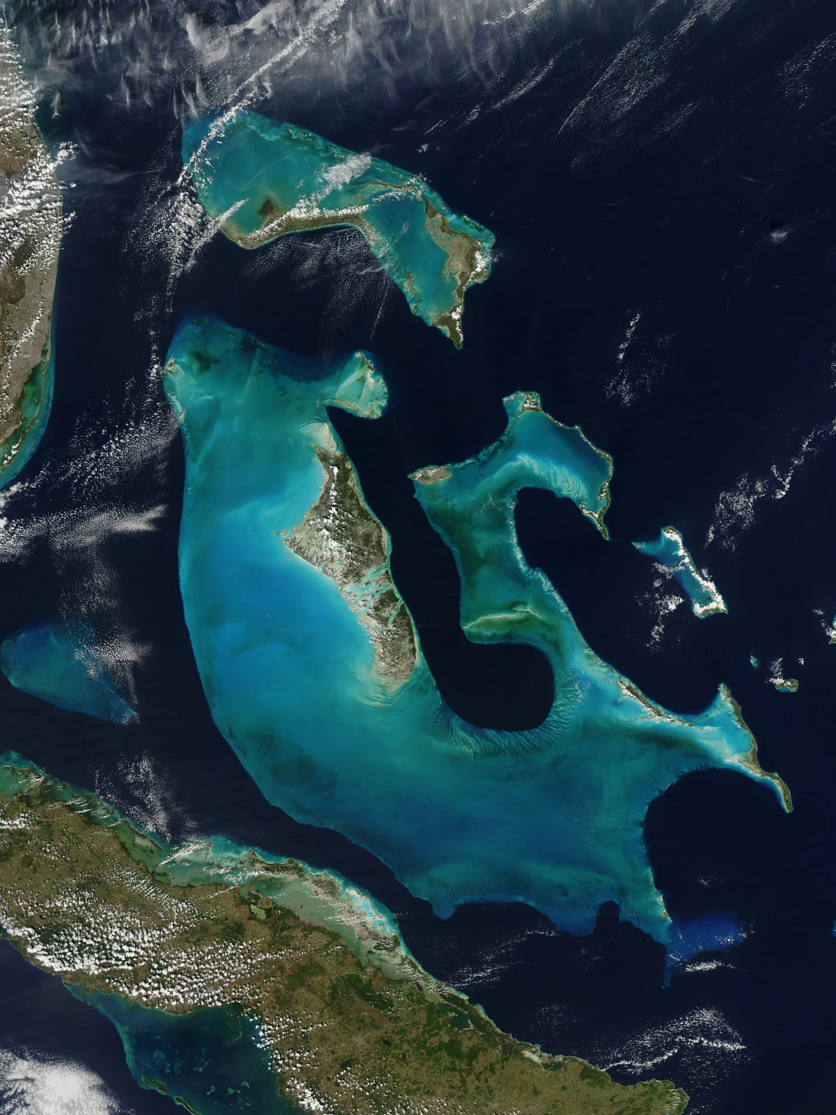
The Bahamas
Seen from Aqua, shallow waters trace the banks of the Bahamas in turquoise.
Image details for The Bahamas
The color change reveals underwater relief. Water above the banks is often less than 10 metres deep, while the surrounding basin reaches 4,000 metres, creating a sharp boundary between turquoise and deep blue.
The Bahamas · 2009.02.12
NASA / Jeff Schmaltz, MODIS Rapid Response Team
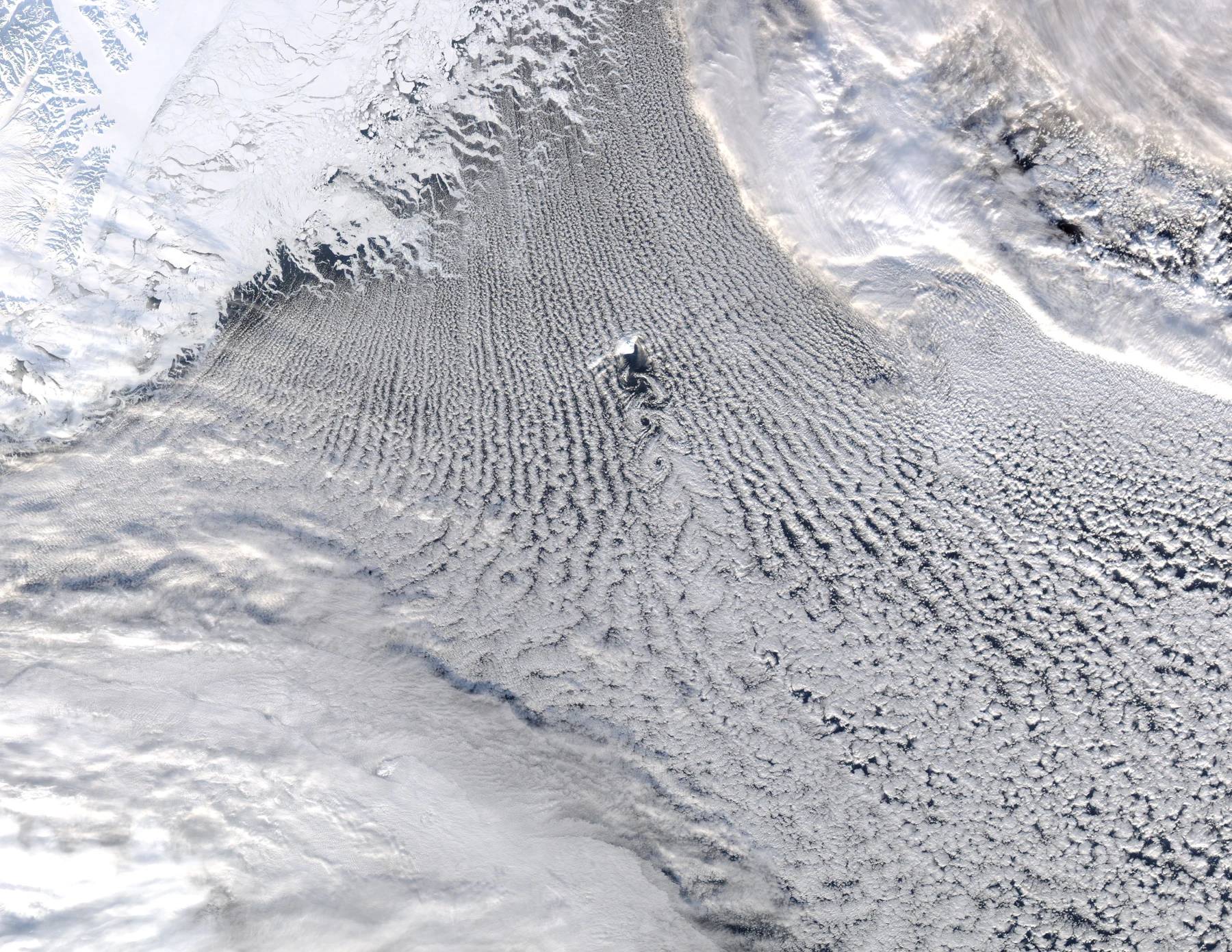
Greenland Sea
Cloud streets cross the Greenland Sea, with vortices forming downwind of Jan Mayen.
Image details for Greenland Sea
Jan Mayen interrupts the wind like a stone in a stream. Air curls into a chain of vortices downwind of the island, while cold northerly winds meeting moist air form the parallel cloud streets.
Greenland Sea · 2009.02.24
NASA / Jeff Schmaltz, MODIS Rapid Response Team
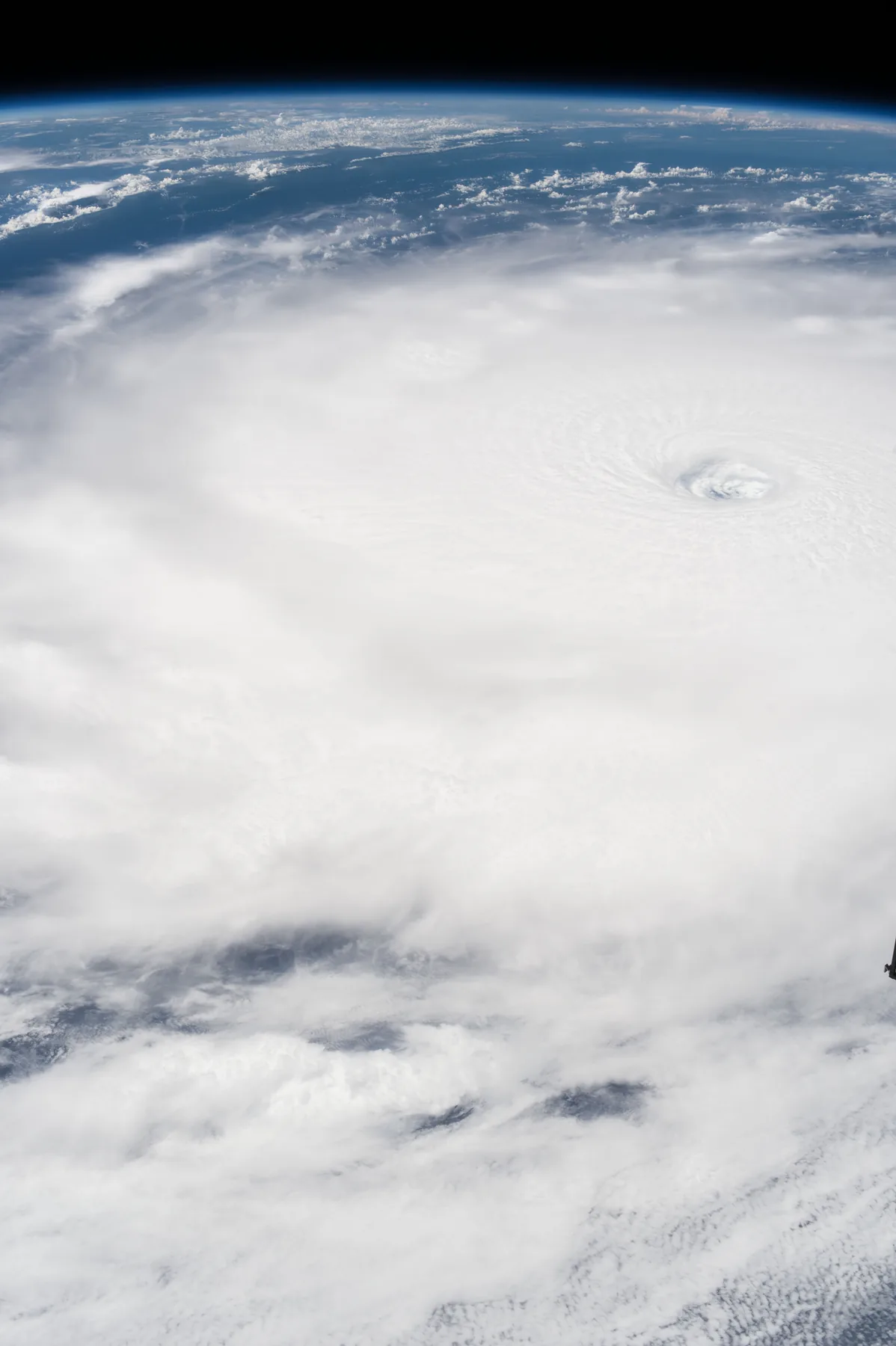
Hurricane Irma
The eye of Hurricane Irma, seen from the International Space Station while the Atlantic storm was at Category 5 strength.
Image details for Hurricane Irma
From orbit, the storm’s eye can be picked out inside the vast cloud field. The station passed over Irma on September 5, 2017, when it was classified as Category 5.
Earth orbit, above the Atlantic Ocean · 2017.09.05
NASA / Paolo Nespoli
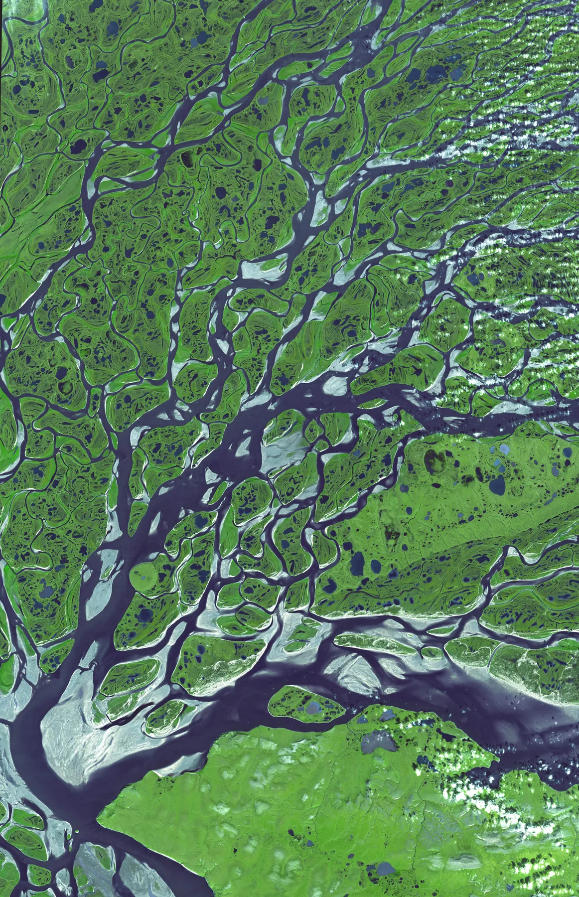
Lena River Delta
The Lena River fans into channels and lakes in the Arctic summer. Seen by Terra’s ASTER instrument.
Image details for Lena River Delta
Only the upper 20–40 centimetres of ground thaw each summer. Frozen ground below holds back drainage, helping the tundra retain its many lakes and ponds through the short Arctic season.
Lena River Delta, Siberia · 2005.07.16
NASA/GSFC/MITI/ERSDAC/JAROS and the U.S./Japan ASTER Science Team
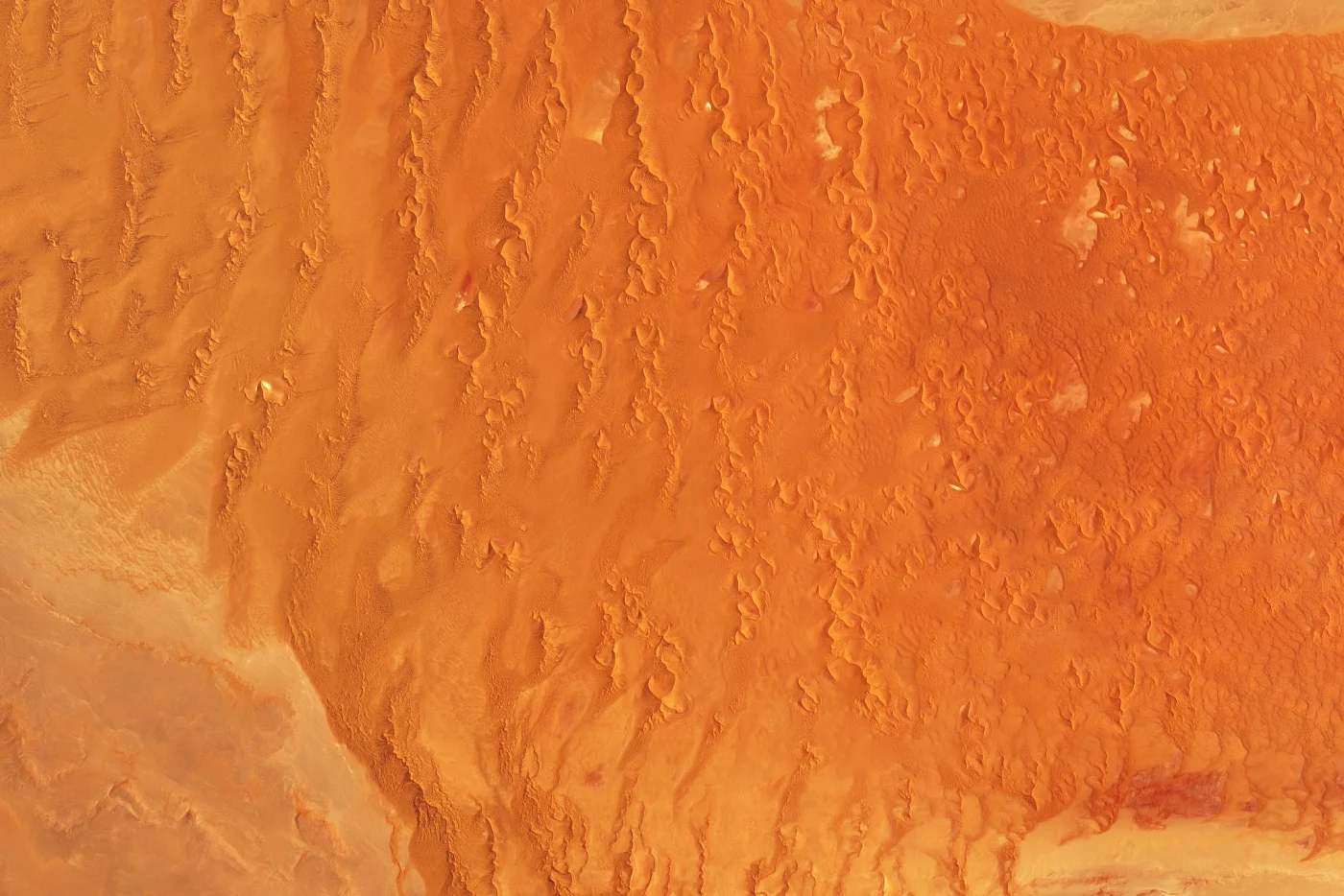
Namib Desert
Wind shapes long, narrow dunes across the Namib Sand Sea.
Image details for Namib Desert
The sand began as sediment carried by the Orange River, then moved inland from the coast on the wind. Iron oxide coatings give the grains their red hue, which deepens farther inland.
Namibia · 2019.11.13
NASA Earth Observatory / Joshua Stevens; USGS Landsat data
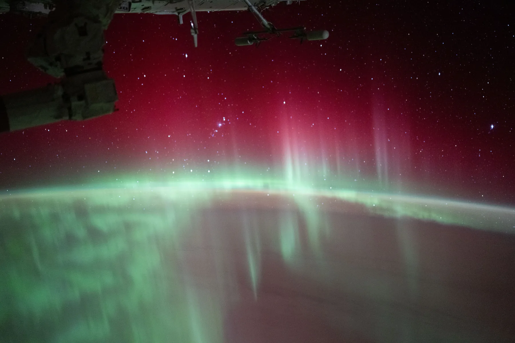
Aurora Australis
Red and green auroras glow above the Indian Ocean. Oxygen atoms in the upper atmosphere produce the light.
Image details for Aurora Australis
Oxygen can glow green or red at different heights. Green light dominates between 100 and 250 kilometres in this view, while red emission can reach about 500 kilometres above Earth.
Earth orbit, above the Indian Ocean · 2024.08.11
NASA / ISS Expedition 71
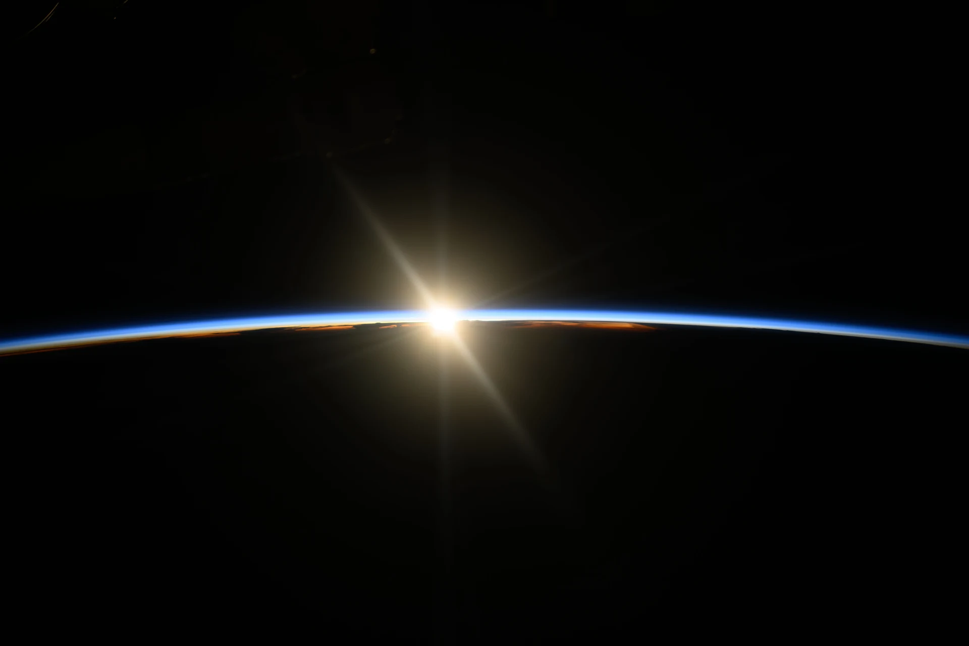
Sunrise
The first sunlight reaches the atmosphere as the International Space Station crosses the Pacific.
Image details for Sunrise
Astronaut photographs are more than views from orbit. Repeated observations help scientists follow changes on Earth, from glacier movement to natural disasters, and support responses on the ground.
Earth orbit, above the Pacific · 2024.08.15
NASA / Matthew Dominick